 Think globally, act locally
Hadstock Habitat Maps
Hadstock Parish Habitat Map
We are mapping our habitats (grassland, woods, hedges, ponds, gardens) across the Hadstock Parish using a survey process defined by the JNCC (Joint Nature Conservation Committee).
The current state of this map is shown below after transferring a series of physical maps into a master digital map. From this digital map we can select areas and overlay different types of information.
The field surveys were carried out by Hadstock villagers accompanied by volunteers from the Uttlesford Branch of the Essex Wildlife Trust.
We are also undertaking a series of nature surveys – bird and butterfly surveys supported by the EWT volunteers and a wildflower survey supported by the Saffron Walden Wildflower Group.

Many thanks to the team that went out and produced the maps – and who all agreed that they really enjoyed this new experience.
Our guide from Uttlesford EWT Group: Tony Morton, without whose guidance we would never have started or succeeded!
From the Village: Russell Hollinshead, Alan Wells, Jane Jennings, Denise Wells, Mel Abbiss, Derek Bushell, Vicky Henniker, Sally Muddiman, Ian Jennings, Peter Wiles, John Lockton
From EWT: Dave McLellan, Peter Hanson, Steve Easom, Will Cockerell, John Welham, Tim Rumsey, Alice Whitaker
And very many thanks to Richard Dolby for producing the wonderful paper and digital maps
Maps created to date
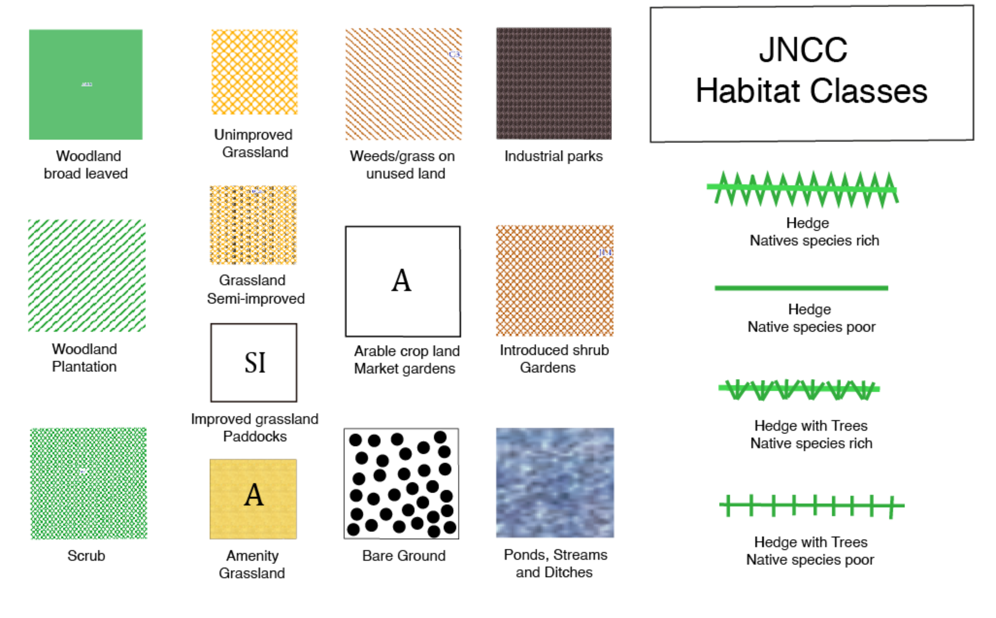
Habitat classes
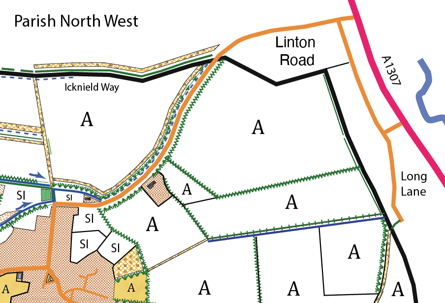
Parish v4 North West.
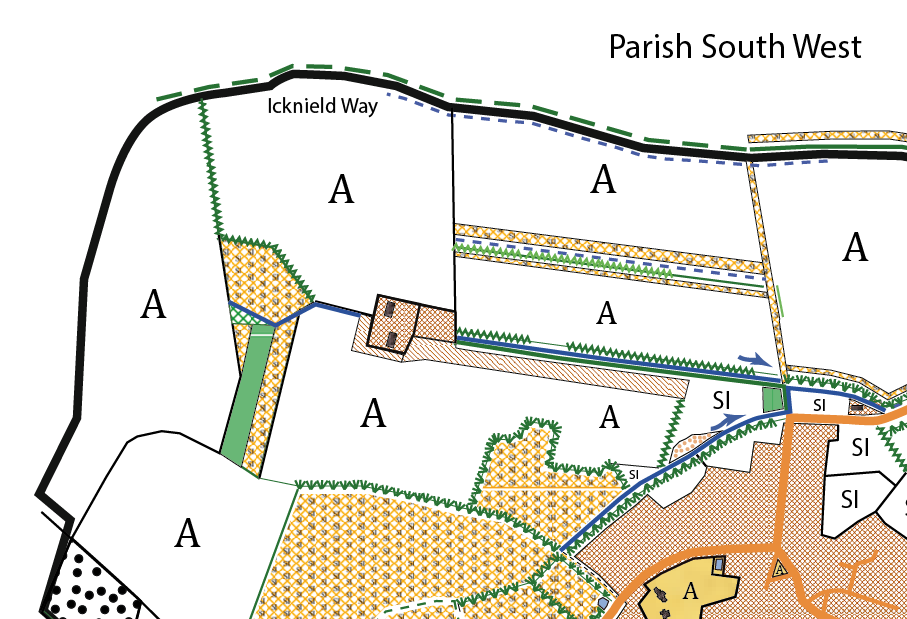
Parish v4 South West
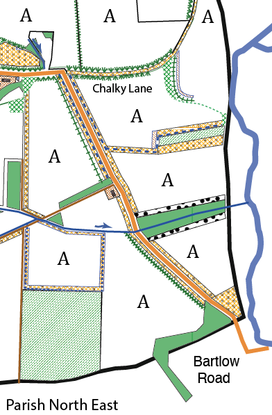
Parish v4 North East portrait
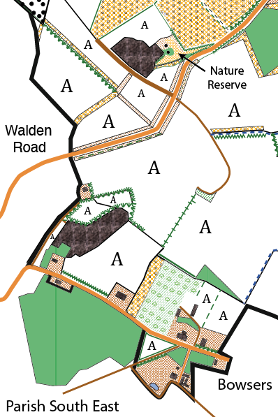
Parish v4 South East portrait
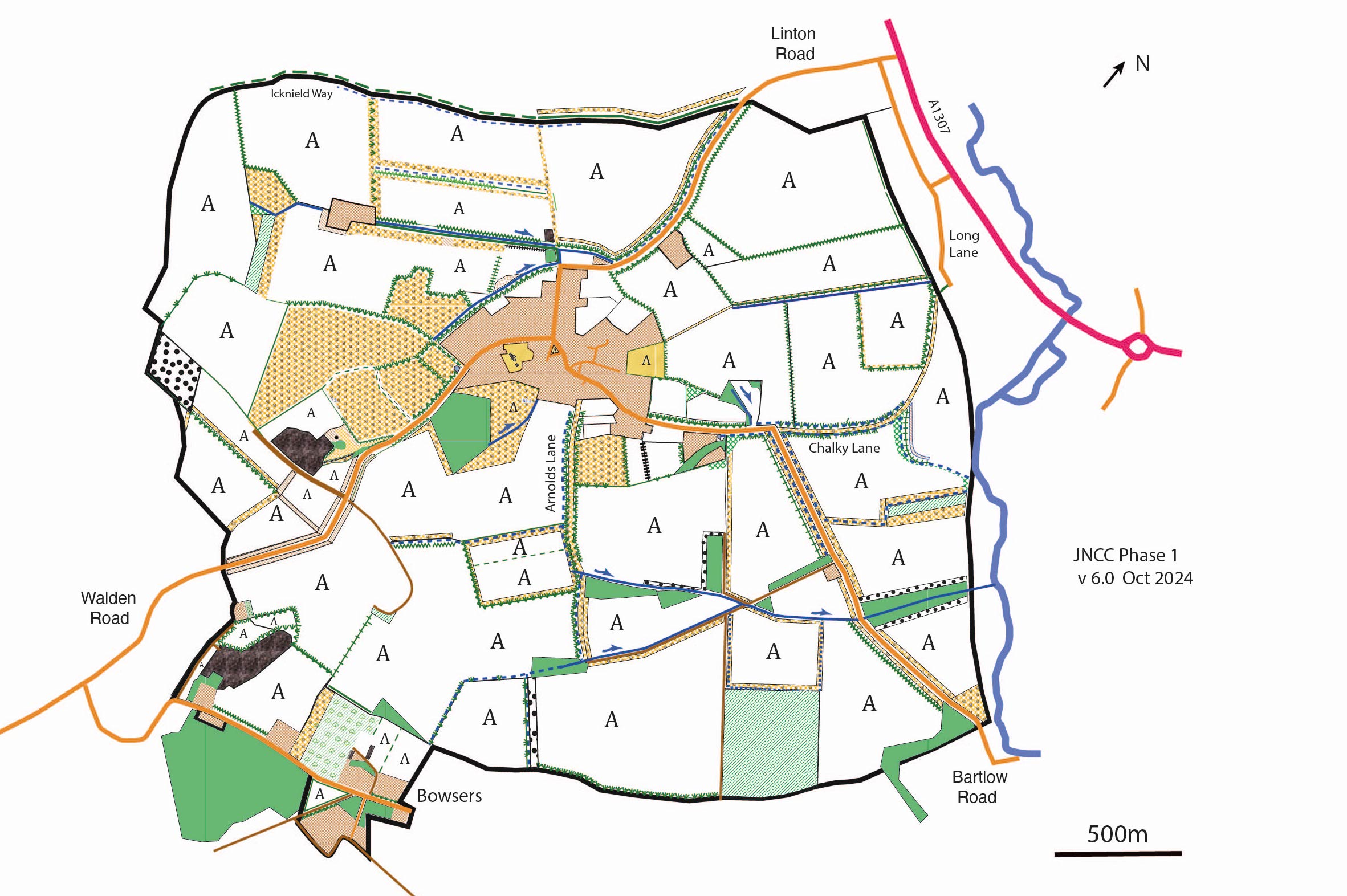
Parish JNCC Phase 1 – Oct 2024
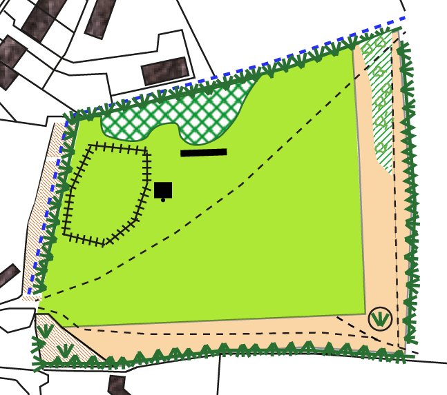
Recreation Ground Oct 2024
Contacts
- Russell Holinshead
- Richard Dolby
Our Supporters
![]()
![]()
![]()
![]()